Highway to health: how we mapped 75% of the health centers in the DRC
Vous pouvez lire ce blog en français ici.
Improving geospatial data in the DRC
Good geospatial data is the foundation of all health strategy planning! Whether it is to assess healthcare access through accessibility models, to establish the optimal location of a new health center, to effectively plan an immunization campaign or drug distribution, to find out where human resource needs are most relevant, etc… Those activities can only be conducted if we have precise data on the location of health centers.
Until recently, however, the geospatial information contained in the national health system in the DRC was relatively limited. As recently as 2020, the precise location of only one-third of health facilities was known. As part of a collective effort around the Ministry of Health’s Mapping for Health project, Bluesquare was able to contribute to the effort to improve the coverage of this information, thanks to funding from USAID and the Bill & Melinda Gates Foundation.
Improving the location of health centers
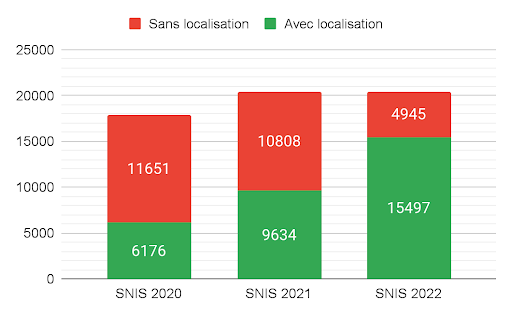
In 2020, a first effort to consolidate different existing sources of location information was made. It allowed the increase of the number of health facilities in the National Health Information System (SNIS) with geographic coordinates from 35 to 73% (see our previous blog on Health Facility Registry Matching). But at that time, only the most reliable coordinates were integrated in the National Health Information System (SNIS). The SNIS had thus gone from 6,000 to 9,000 geolocated facilities out of 17,000.
Since then, Bluesquare, in collaboration with the technical working group on this topic led by the Ministry of Health and coordinated by our colleagues from GRID3, has continued to improve the methodology and gather new data sources. This let us further increase the number of health facilities with precise geographic coordinates.
The first challenges we encounter in aggregating different databases are the lack of unique identifiers and the fact that structure names are written differently across different sources. We therefore need to first find a method to match them. Then, once this matching has been done, we need to determine the correct geographic information for each health center. This information for the same health center can indeed sometimes be divergent! Due to the amount of data to be matched, these 2 steps are performed algorithmically.
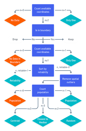
Matching algorithm
This algorithm matches facilities in a reference dataset (SNIS) to a target dataset based on name, facility type, location in the health pyramid, and the administrative boundaries of their parents (areas, zones and provinces). Health facilities can be matched using exact matching (names and types of health facilities are identical) or fuzzy matching (names and types of health facilities are similar).
GPS selection algorithm
After a successful mapping process, some health facilities have several location data available from various data sources. The coordinates selection process allows one to choose the best data source based on multiple criteria: consistency with the pyramid geometry, arbitrary reliability, population distribution, etc.
Results achieved
In May 2022, thanks to the work done with the technical group, the SNIS has access to geographical information for 15,497 structures out of the 20,422 currently registered in the SNIS, i.e. 75.8% of healthcare facilities!
The maps below illustrate the proportion of health facilities with known location by province (left in 2020, right in May 2022)
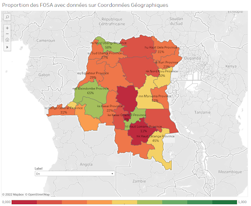
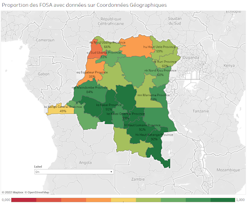
We can see that there are still strong disparities between the provinces but the goal is to reach 100% by the end of 2022.
The public interface to view the information content available in the National Health Information System (SNIS) is available through the following link. All data can be downloaded in xlsx format by clicking on the export button at the bottom of the page.
Complete the data: your help is welcome!
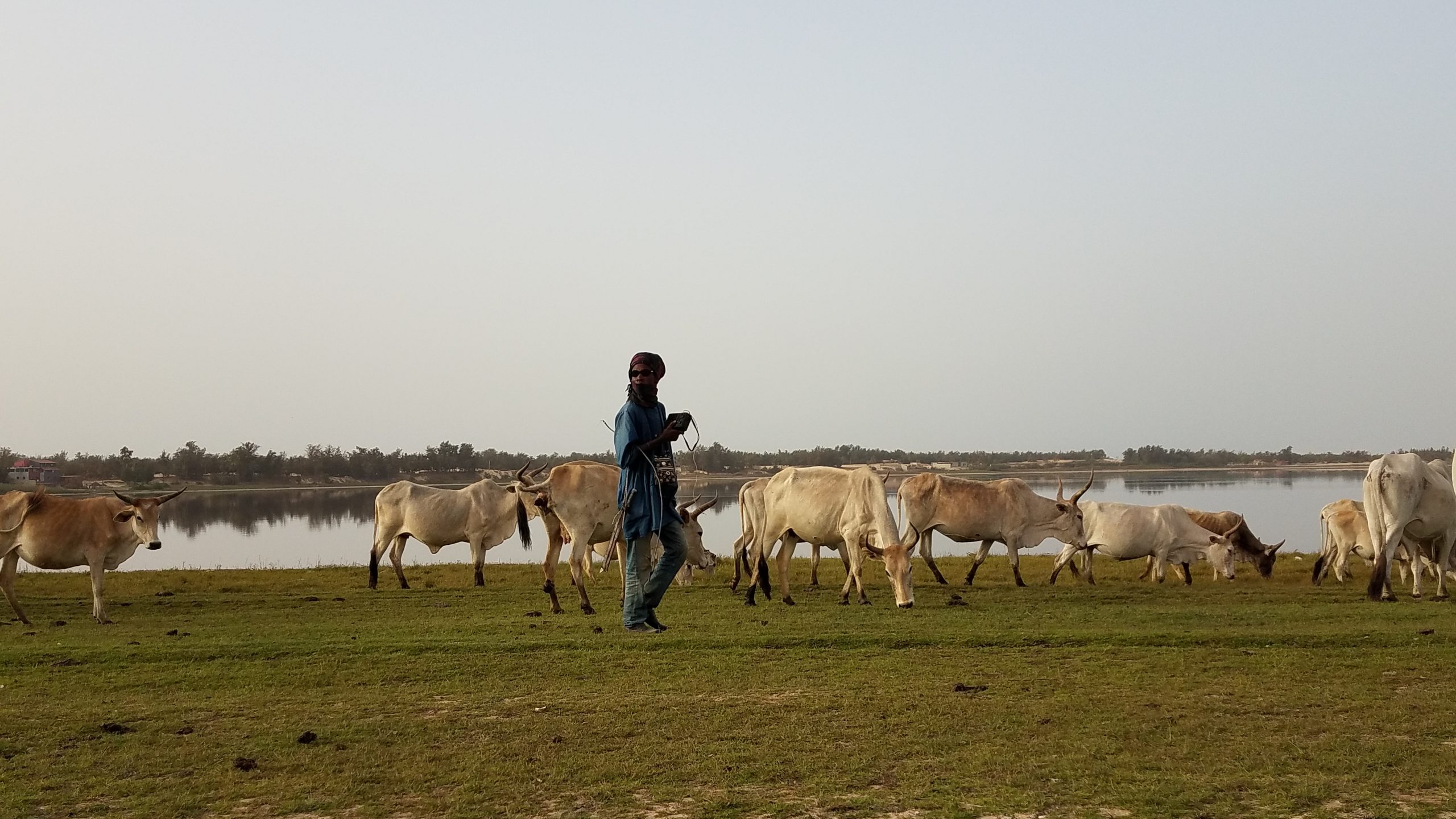
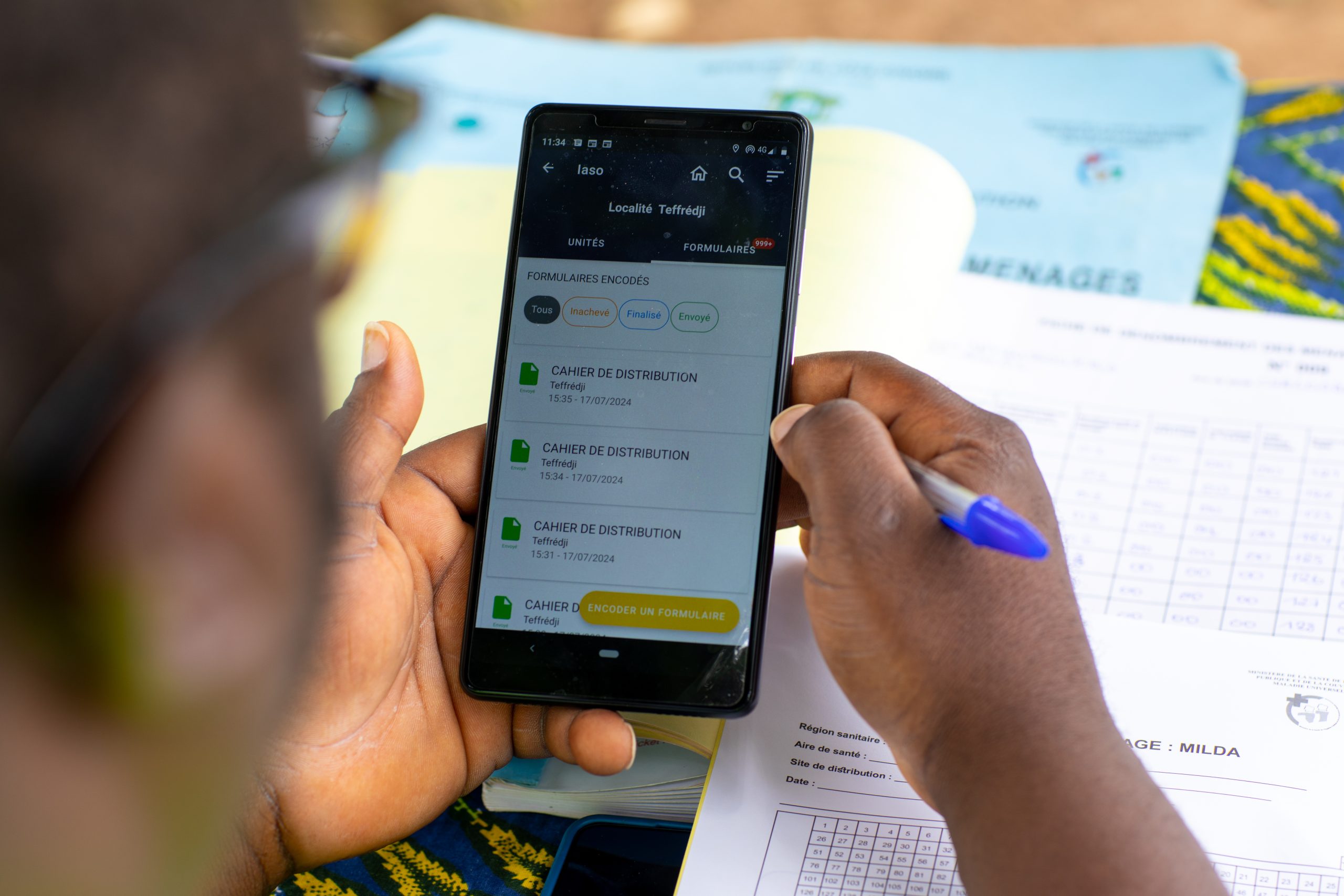
The Ministry of Health has developed collection tools to complete the missing geographic data, through a mobile application collecting a photo and location, and also an annual canvas, to obtain additional baseline data on all health facilities in the DRC. A first successful pre-test was carried out in November 2021 in 2 health zones of Haut-Katanga, and these tools are being popularized and deployed nationwide to progressively cover the different provinces.
Thus, any NGO, donor or technical partner having geographic data or wishing to participate in this collection effort should not hesitate to contact the Ministry (contact person: Bernice Ngiongi, DSNIS, bernice.ngiongi@sante.gouv.cd) or us for more information. All additional data sources are welcome!